Wintry Weather to Rain Chances In The Northeast

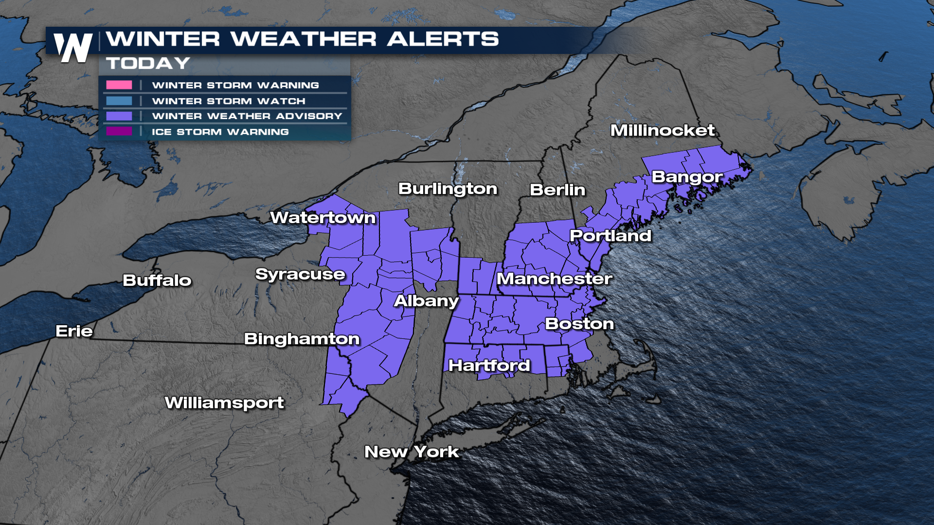
NORTHEAST - We've had a series of clipper systems move from the Northern Plains over the Great Lakes and past the Northeast over a lot of the Christmas holidays. Now that we're back for the first full week of work and school, we have more of the same. Through tonight, winter weather advisories have been issued for portions of northern New England for a bit of sleet, ice, and a couple of quick inches of snowfall. This will likely lead to slick spots on the road tonight and tomorrow morning.
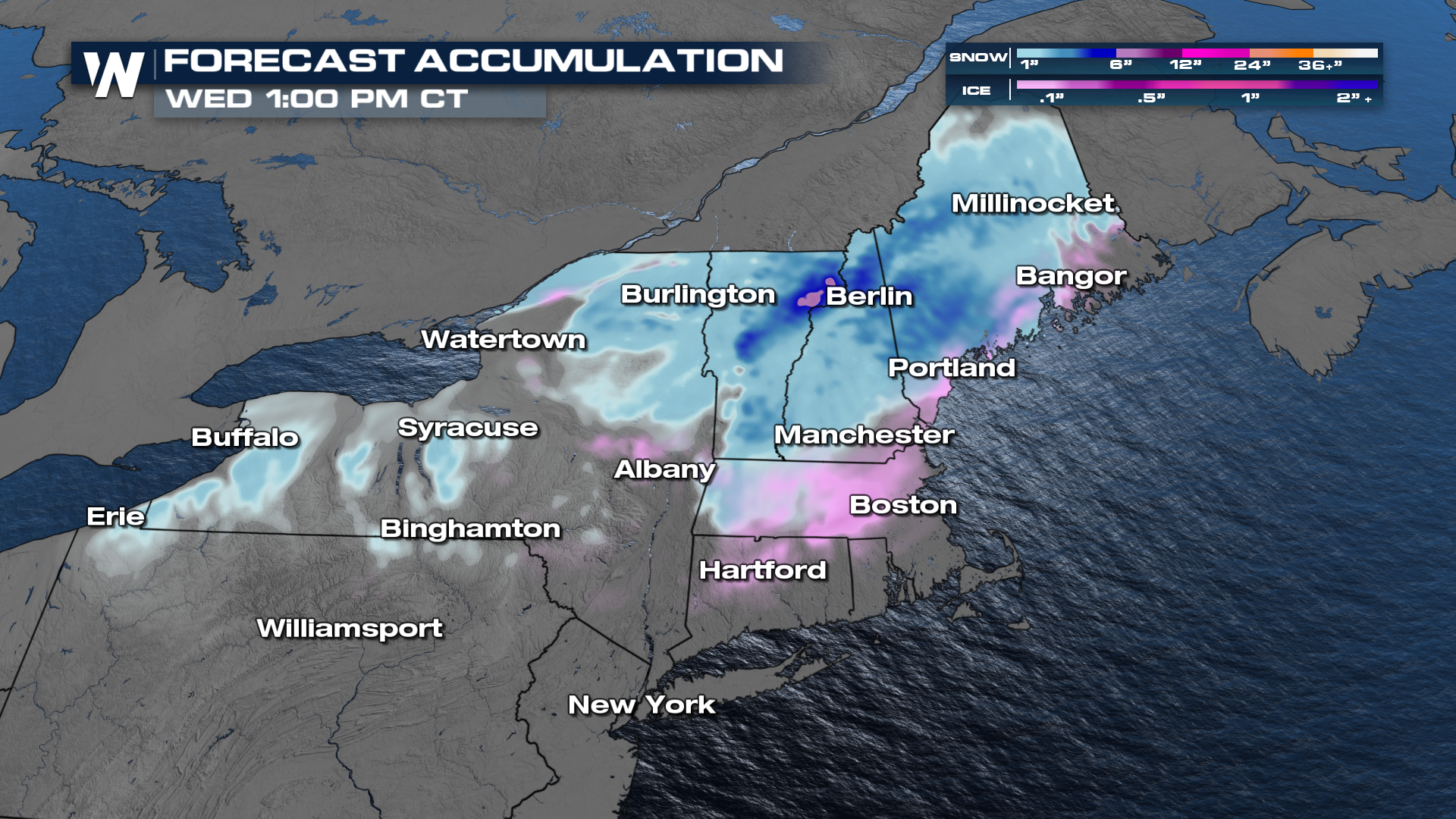
Here's a look at our forecast totals from now through Wednesday. Higher elevations may see more than a couple of inches, but otherwise, totals will be fairly minimal.
Timing things out through Wednesday morning, we currently have a wintry mix pushing through the northeast along a frontal boundary and that will continue through Wednesday morning in these areas.
Next System To Watch
After we receive a little bit of snowfall, another warmer system is set to move into the northeast as we head into the latter half of the work week. With warmer temperatures in store, this will likely bring in more rain than snowfall. That could lead to some slushy conditions, especially if you have snowfall on the ground in your area. Rain starts to push in Thursday through Saturday.
For more of these details be sure to join us LIVE on WeatherNation!


